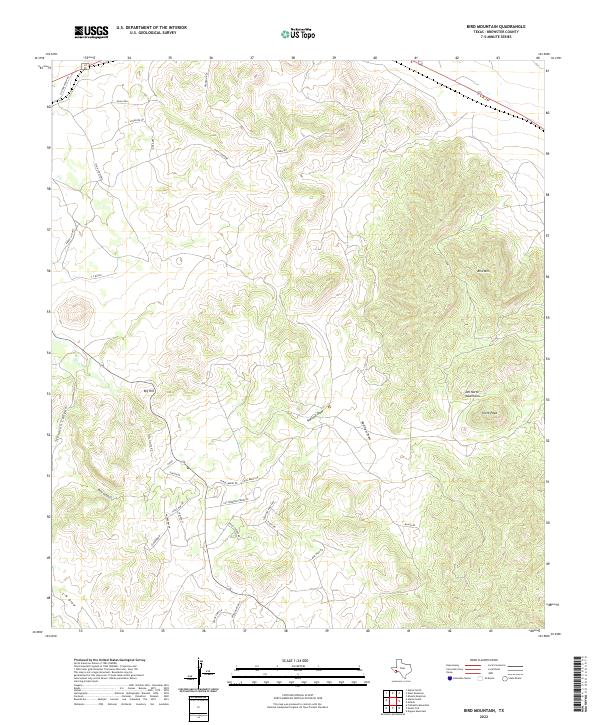
2022 Map of Bird Mountain
USGS Topo · Published 2022About this map
The high-elevation landscape of the Del Norte Mountains dominates this portion of Brewster County, featuring prominent peaks and intricate drainage systems. Bird Mtn and Smith Peak stand as central landmarks within this rugged terrain, while the northern reaches are marked by elevations like High Lonesome and Dark Sky. The settlement pattern is characterized by large-scale ranching, notably at the C F Ranch, and a network of specialized local roads including Mile High Rd and Pronghorn Xing. Water moves through the environment via named ephemeral features such as Stockton Canyon, Bear Canyon, and Ramsey Draw. This modern topographic survey reveals the transition from open ridge-and-valley topography to the more developed residential road networks found near Sierra La Rana and along Cielo Vista Rd in the southwest.
Find a feature on this map
34 named features on this map. Tap any name to fly to it.
Don’t see what you’re looking for? This feature index may not catch every label — zoom into the map to look around manually.
Map Details
Editions of this 2022 Bird Mountain Map
This is the sole edition of this map. No revisions or reprints were ever made.
Other maps of this area

1895 · Alpine
USGS Topo · 1:125,000

1920 · Monument Spring
USGS Topo · 1:62,500

1921 · Monument Spring
USGS Topo · 1:62,500

1923 · Altuda
USGS Topo · 1:62,500

1954 · Fort Stockton
USGS Topo · 1:250,000

1958 · Fort Stockton
USGS Topo · 1:250,000

1972 · Bird Mountain
USGS Topo · 1:24,000

1972 · Alpine North
USGS Topo · 1:24,000

1972 · Alpine South
USGS Topo · 1:24,000

1972 · Elam Mountain
USGS Topo · 1:24,000