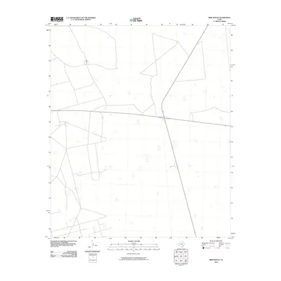
2010 Map of Bird Ranch
USGS Topo · Published 2010About this map
Bird Ranch sits at the heart of this high plains landscape in Andrews County, where the cattle-ranching heritage of West Texas meets the intersecting paths of the modern era. The property is positioned northwest of a prominent crossroads, where state highway 176 runs east-to-west across the terrain to meet highway 349. The map reveals a sparse network of ranching roads and tracks that delineate large parcels of land, characteristic of the expansive pastoral holdings in this part of the Llano Estacado. Small depressions and localized topography are noted across the quadrangle, reflecting the subtle drainage patterns and natural catchment areas essential for livestock in a semi-arid region.
Find a feature on this map
3 named features on this map. Tap any name to fly to it.
Don’t see what you’re looking for? This feature index may not catch every label — zoom into the map to look around manually.
Map Details
Editions of this 2010 Bird Ranch Map
This is the sole edition of this map. No revisions or reprints were ever made.
Other maps of this area

1954 · Hobbs
USGS Topo · 1:250,000

1958 · Hobbs
USGS Topo · 1:250,000

1966 · Wolcott Ranch
USGS Topo · 1:24,000

1966 · Mabee Ranch
USGS Topo · 1:24,000

1966 · Flynt Ranch
USGS Topo · 1:24,000

1966 · Scharbauer Ranch
USGS Topo · 1:24,000

1966 · Bird Ranch
USGS Topo · 1:24,000

1966 · North Curtis Ranch
USGS Topo · 1:24,000

1968 · Baird Lake
USGS Topo · 1:24,000

1971 · Five Wells Ranch SE
USGS Topo · 1:24,000