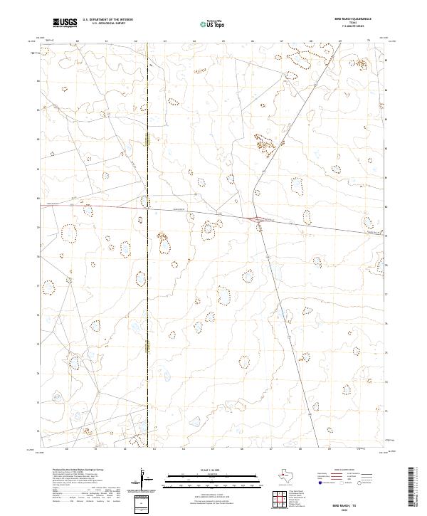
2022 Map of Bird Ranch
USGS Topo · Published 2022About this map
Andrews Co and Martin Co meet along a straight north-south boundary in this high plains region of West Texas. The landscape is defined by its vastness and sparse infrastructure, where cattle ranching and energy interests dictate the layout of the land. Ranch Rd 87 serves as the primary east-west artery, bisecting the quadrangle and intersecting with local routes like Co Rd 100 and Ne 100. The terrain is characterized by numerous small, intermittent depressions and ponds that dot the surface, reflecting the specialized hydrology of the Permian Basin. This survey captures the region in its modern state, showing the minimal but vital network of roads that connect these remote ranching outposts across the county line.
Find a feature on this map
4 named features on this map. Tap any name to fly to it.
Don’t see what you’re looking for? This feature index may not catch every label — zoom into the map to look around manually.
Map Details
Editions of this 2022 Bird Ranch Map
This is the sole edition of this map. No revisions or reprints were ever made.
Other maps of this area

1954 · Hobbs
USGS Topo · 1:250,000

1958 · Hobbs
USGS Topo · 1:250,000

1966 · Wolcott Ranch
USGS Topo · 1:24,000

1966 · Mabee Ranch
USGS Topo · 1:24,000

1966 · Flynt Ranch
USGS Topo · 1:24,000

1966 · Scharbauer Ranch
USGS Topo · 1:24,000

1966 · Bird Ranch
USGS Topo · 1:24,000

1966 · North Curtis Ranch
USGS Topo · 1:24,000

1968 · Baird Lake
USGS Topo · 1:24,000

1971 · Five Wells Ranch SE
USGS Topo · 1:24,000