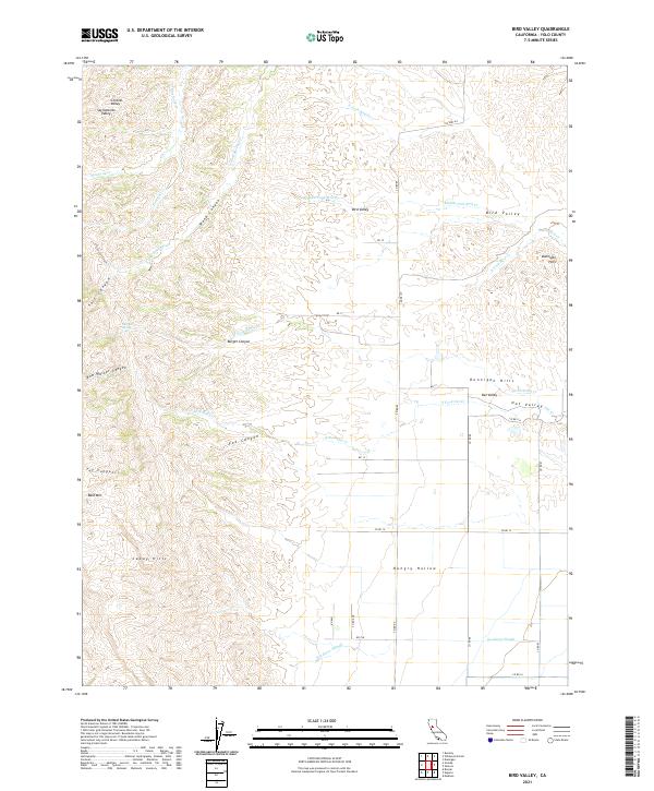
2021 Map of Bird Valley
USGS Topo · Published 2021About this map
The Capay Hills rise sharply above the western edge of the Central Valley in this topographic study of Yolo County. The landscape is defined by a complex network of seasonal drainages and canyons, including Salt Canyon, Fox Canyon, and the deeply etched Tut Canyon, which all descend from the high point at Bald Mtn. East of these heights, the land transitions into the productive agricultural flats of Hungry Hollow and the rolling terrain of the Dunnigan Hills. The map traces the winding paths of several forks of Bird Cr and Oat Valley Oat Cr, showing a rural infrastructure dominated by county roads like Co Rd 85 and Co Hwy E4 that follow the section lines of the Public Land Survey System. The presence of Sulphur Spring near Burger Canyon highlights the area's natural mineral features amidst its rugged ranching and farming history.
Find a feature on this map
46 named features on this map. Tap any name to fly to it.
Don’t see what you’re looking for? This feature index may not catch every label — zoom into the map to look around manually.
Map Details
Editions of this 2021 Bird Valley Map
This is the sole edition of this map. No revisions or reprints were ever made.
Other maps of this area

1905 · Harrington
USGS Topo · 1:24,000

1905 · Esparto
USGS Topo · 1:24,000

1907 · Dunnigan
USGS Topo · 1:62,500

1907 · Woodland
USGS Topo · 1:62,500

1916 · Jacobs Corner
USGS Topo · 1:31,680

1916 · Harrington
USGS Topo · 1:31,680

1916 · Hershey
USGS Topo · 1:31,680

1916 · Zamora
USGS Topo · 1:31,680

1916 · Esparto
USGS Topo · 1:31,680

1924 · Capay
USGS Topo · 1:62,500