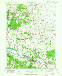
1947 Map of Birdsboro
USGS Topo · Published 1967About this map
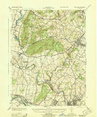
The Schuylkill River carves through this Berks County landscape, where industrial remnants and deep colonial roots sit side-by-side. The town of Birdsboro serves as a primary hub, characterized by complex rail infrastructure including the Reading Pennsylvania Belt Line and several segments of the Reading Canal. Outside the industrial corridor, the map preserves significant historical sites like the Daniel Boone Homestead and the De Benneville House, reflecting the area’s early 18th-century settlement. Numerous smaller communities such as Baumstown, Stonetown, and Jacksonwald are scattered across the hills, often organized around local landmarks like the Exeter Friends Meeting House or neighborhood schools like Seideltown Sch. The terrain is marked by distinctive elevations like Monocacy Hill and Schwarzwald Hill, while numerous water-powered sites such as Beavers Mill and Flannery Mill indicate the legacy of the local milling economy.
Find a feature on this map
83 named features on this map. Tap any name to fly to it.
Don’t see what you’re looking for? This feature index may not catch every label — zoom into the map to look around manually.
Map Details
Editions of this 1947 Birdsboro Map
4 editions found
Other maps of this area

1894 · Reading
USGS Topo · 1:62,500

1902 · Boyertown
USGS Topo · 1:62,500

1905 · Honey Brook
USGS Topo · 1:62,500

1906 · Phoenixville
USGS Topo · 1:62,500

1907 · Honeybrook
USGS Topo · 1:62,500

1913 · Reading
USGS Topo · 1:62,500

1915 · Reading
USGS Topo · 1:62,500

1941 · Honeybrook
USGS Topo · 1:62,500

1943 · Manatawny
USGS Topo · 1:31,680
1943 · Boyertown
USGS Topo · 1:31,680
Featured Places
- Birdsboro, PA
- Oley Township, PA
- Village of Jacksonwald, Exeter Township
- Union Township, PA
- St. Lawrence, PA