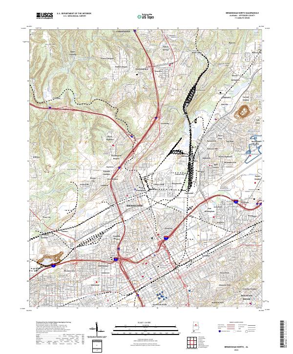
2024 Map of Birmingham North
USGS Topo · Published 2024About this map
Opossum Valley and Jones Valley form the industrial and cultural heart of this Jefferson County landscape, defined by a dense network of neighborhoods and iron-age infrastructure. The map reveals the proximity of historically significant sites like the Birmingham Civil Rights National Monument to academic centers such as Birmingham Southern College and the University of Alabama at Birmingham. Waterways like Village Creek and Fivemile Creek thread through residential pockets and industrial corridors, while the presence of the L & N RR and landmarks like Boyles Gap underscore the area's history as a transportation hub. Numerous legacy sites, including Walkers Chapel Cem and Knesses Israel Cem, provide essential grounding for genealogical research in these long-established communities.
Find a feature on this map
146 named features on this map. Tap any name to fly to it.
Don’t see what you’re looking for? This feature index may not catch every label — zoom into the map to look around manually.
Map Details
Editions of this 2024 Birmingham North Map
This is the sole edition of this map. No revisions or reprints were ever made.
Other maps of this area

1889 · Birmingham
USGS Topo · 1:125,000

1890 · Bessemer
USGS Topo · 1:125,000

1892 · Birmingham
USGS Topo · 1:125,000

1892 · Bessemer
USGS Topo · 1:125,000

1895 · Birmingham
USGS Topo · 1:125,000

1904 · Birmingham Coal District
USGS Topo · 1:62,500

1905 · Bessemer Iron District
USGS Topo · 1:62,500

1905 · Leeds
USGS Topo · 1:62,500

1906 · Birmingham Special
USGS Topo · 1:62,500

1906 · Vandiver
USGS Topo · 1:62,500