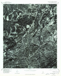
1975 Map of Birmingham North
USGS Topo · Published 1977About this map
The industrial and urban heart of northern Alabama is revealed through the high-altitude lens of this 1975 orthophotoquad. Centered on Birmingham, the imagery captures the complex weave of highway interchanges, rail lines, and residential density during a period of significant regional transformation. Unlike a standard topographic sheet, this photo-based map shows the literal footprint of the city, from the sprawl of urban neighborhoods to the massive industrial clearings and quarrying operations that define the northern outskirts near Fultondale. By merging aerial photography with geodetic precision, the U.S. Geological Survey provided a clear record of the area's physical development just before the technological shifts of the late 20th century. For historians, it offers an unvarnished look at the landscape's utility, showing how topography and industry dictated the growth of the Magic City.
Find a feature on this map
2 named features on this map. Tap any name to fly to it.
Don’t see what you’re looking for? This feature index may not catch every label — zoom into the map to look around manually.
Map Details
Editions of this 1975 Birmingham North Map
This is the sole edition of this map. No revisions or reprints were ever made.
Other maps of this area

1889 · Birmingham
USGS Topo · 1:125,000

1890 · Bessemer
USGS Topo · 1:125,000

1892 · Birmingham
USGS Topo · 1:125,000

1892 · Bessemer
USGS Topo · 1:125,000

1895 · Birmingham
USGS Topo · 1:125,000

1904 · Birmingham Coal District
USGS Topo · 1:62,500

1905 · Bessemer Iron District
USGS Topo · 1:62,500

1905 · Leeds
USGS Topo · 1:62,500

1906 · Birmingham Special
USGS Topo · 1:62,500

1906 · Vandiver
USGS Topo · 1:62,500