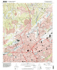
1997 Map of Birmingham North
USGS Topo · Published 2001About this map
Industrial infrastructure and dense urban neighborhoods define this northern Birmingham landscape, where the heavy rail operations of the East Thomas Yards and a notable Strip Mine north of Coalburg reveal the city's 20th-century economic foundations. The map provides a detailed view of the social fabric through its numerous educational and religious institutions, ranging from the historic St Pauls Cathedral downtown to the hilltop campus of Birmingham Southern College. Neighborhoods like Pratt City, Inglenook, and Sayreton are mapped in detail alongside significant landmarks such as the storied Rickwood Field and the sprawling Birmingham Municipal Airport on the eastern edge. This record illustrates the transition from the rugged mining terrain of Lassie Mountain to the organized street grids of Tarrant and North Birmingham, showing the city's growth just before the turn of the millennium.
Find a feature on this map
126 named features on this map. Tap any name to fly to it.
Don’t see what you’re looking for? This feature index may not catch every label — zoom into the map to look around manually.
Map Details
Editions of this 1997 Birmingham North Map
This is the sole edition of this map. No revisions or reprints were ever made.
Other maps of this area

1889 · Birmingham
USGS Topo · 1:125,000

1890 · Bessemer
USGS Topo · 1:125,000

1892 · Birmingham
USGS Topo · 1:125,000

1892 · Bessemer
USGS Topo · 1:125,000

1895 · Birmingham
USGS Topo · 1:125,000

1904 · Birmingham Coal District
USGS Topo · 1:62,500

1905 · Bessemer Iron District
USGS Topo · 1:62,500

1905 · Leeds
USGS Topo · 1:62,500

1906 · Birmingham Special
USGS Topo · 1:62,500

1906 · Vandiver
USGS Topo · 1:62,500