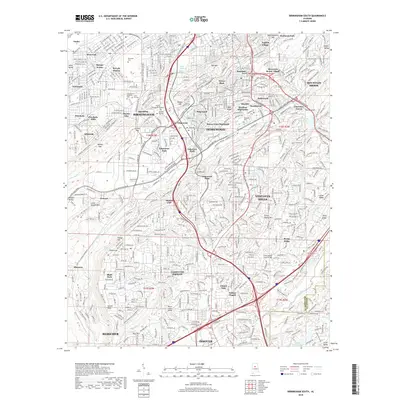
2018 Map of Birmingham South
USGS Topo · Published 2018About this map
Birmingham and its southern suburbs sit atop a complex landscape of ridges and gaps, where the urban grid of neighborhoods like Ensley and West End transitions into the steep topography of Red Mountain and Shades Mountain. This modern survey documents the established suburban growth of Homewood, Vestavia Hills, and Hoover, following the historical corridors that cut through the terrain at Graces Gap and Red Mountain Gap. The map details the significant green spaces and institutions that define the area, including the sprawling grounds of Elmwood Cemetery, the campus of Samford University, and the Birmingham Reservoir. To the southeast, the terrain softens as it approaches the Cahaba River, while landmarks like the Old Florida Short Route and Shadowlawn Memorial Park Cemetery provide points of interest for local history and genealogical research.
Find a feature on this map
87 named features on this map. Tap any name to fly to it.
Don’t see what you’re looking for? This feature index may not catch every label — zoom into the map to look around manually.
Map Details
Editions of this 2018 Birmingham South Map
This is the sole edition of this map. No revisions or reprints were ever made.
Other maps of this area

1889 · Birmingham
USGS Topo · 1:125,000

1890 · Bessemer
USGS Topo · 1:125,000

1892 · Birmingham
USGS Topo · 1:125,000

1892 · Bessemer
USGS Topo · 1:125,000

1895 · Birmingham
USGS Topo · 1:125,000

1904 · Birmingham Coal District
USGS Topo · 1:62,500

1905 · Bessemer Iron District
USGS Topo · 1:62,500

1905 · Leeds
USGS Topo · 1:62,500

1906 · Birmingham Special
USGS Topo · 1:62,500

1906 · Vandiver
USGS Topo · 1:62,500