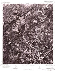
1975 Map of Birmingham South
USGS Topo · Published 1977About this map
Birmingham dominates the northern portion of this orthophotograph, where the city’s dense urban grid begins to give way to the complex topography of the south. This 1975 aerial perspective reveals the residential expansion and suburban density occurring across Homewood and Mountain Brook, showing how development was shaped by the ridgelines and valleys characteristic of the area. Unlike traditional line maps, this orthophoto provides a literal view of the mid-1970s landscape, documenting the precise footprints of housing developments, commercial corridors, and the winding road networks that define these communities during a period of significant growth in Jefferson County.
Find a feature on this map
3 named features on this map. Tap any name to fly to it.
Don’t see what you’re looking for? This feature index may not catch every label — zoom into the map to look around manually.
Map Details
Editions of this 1975 Birmingham South Map
This is the sole edition of this map. No revisions or reprints were ever made.
Other maps of this area

1889 · Birmingham
USGS Topo · 1:125,000

1890 · Bessemer
USGS Topo · 1:125,000

1892 · Birmingham
USGS Topo · 1:125,000

1892 · Bessemer
USGS Topo · 1:125,000

1895 · Birmingham
USGS Topo · 1:125,000

1904 · Birmingham Coal District
USGS Topo · 1:62,500

1905 · Bessemer Iron District
USGS Topo · 1:62,500

1905 · Leeds
USGS Topo · 1:62,500

1906 · Birmingham Special
USGS Topo · 1:62,500

1906 · Vandiver
USGS Topo · 1:62,500