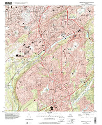
1997 Map of Birmingham South
USGS Topo · Published 2001About this map
Elmwood Cemetery and the industrial suburbs of Birmingham occupy the northern hills of this landscape, where the iron-and-steel legacy of the region is written into the terrain. The topography is defined by the prominent ridge of Shades Mountain, which separates the urban expansion of Homewood and Mountain Brook from the valley development to the south. Evidence of the area's extractive history remains visible at the Spaulding Mine, while the Birmingham Southern RR indicates the heavy rail infrastructure required to move raw materials through the valleys.
Find a feature on this map
81 named features on this map. Tap any name to fly to it.
Don’t see what you’re looking for? This feature index may not catch every label — zoom into the map to look around manually.
Map Details
Editions of this 1997 Birmingham South Map
This is the sole edition of this map. No revisions or reprints were ever made.
Other maps of this area

1889 · Birmingham
USGS Topo · 1:125,000

1890 · Bessemer
USGS Topo · 1:125,000

1892 · Birmingham
USGS Topo · 1:125,000

1892 · Bessemer
USGS Topo · 1:125,000

1895 · Birmingham
USGS Topo · 1:125,000

1904 · Birmingham Coal District
USGS Topo · 1:62,500

1905 · Bessemer Iron District
USGS Topo · 1:62,500

1905 · Leeds
USGS Topo · 1:62,500

1906 · Birmingham Special
USGS Topo · 1:62,500

1906 · Vandiver
USGS Topo · 1:62,500