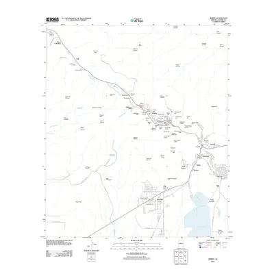
2011 Map of Bisbee
USGS Topo · Published 2011About this map
Bisbee and its surrounding mining-era suburbs dominate this 2011 survey of the Mule Mountains. The complex topography of the district is meticulously detailed, showing how residential clusters like South Bisbee, Bakerville, and Saginaw cling to the steep slopes of Mason Hill and Bailey Hill. The map traces the industrial heritage of the area from the notable Wade Hampton Pit and Tombstone Canyon through the canyon-bound streets of Brewery Gulch. To the southeast, the planned community of Warren and the residential layout of Huachuca Terrace contrast with the dense, older urban core. The transportation corridor through the Mule Pass Tunnel connects the city to the northern ranches, including Rileys El Encinar and Mule Mountain Ranch. This modern survey provides genealogists and local historians an exact record of property footprints and civic infrastructure, from Evergreen Cemetery to the Bisbee Municipal Airport.
Find a feature on this map
120 named features on this map. Tap any name to fly to it.
Don’t see what you’re looking for? This feature index may not catch every label — zoom into the map to look around manually.
Map Details
Editions of this 2011 Bisbee Map
This is the sole edition of this map. No revisions or reprints were ever made.
Other maps of this area

1902 · Bisbee
USGS Topo · 1:62,500

1910 · Bisbee
USGS Topo · 1:62,500

1914 · Hereford
USGS Topo · 1:125,000

1915 · Benson
USGS Topo · 1:125,000

1916 · Pearce
USGS Topo · 1:125,000

1916 · Douglas
USGS Topo · 1:125,000

1919 · Douglas
USGS Topo · 1:125,000

1925 · Gleeson
USGS Topo · 1:62,500

1927 · Bisbee
USGS Topo · 1:62,500

1932 · Stark
USGS Topo · 1:62,500