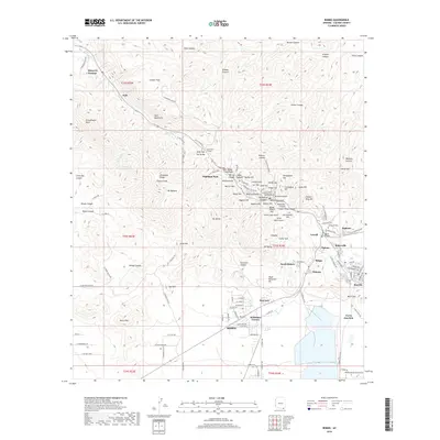
2018 Map of Bisbee
USGS Topo · Published 2018About this map
The Mule Mountains define the character of this 2018 survey, where the complex mining and industrial topography of the Mule Gulch drainage is meticulously recorded. The city of Bisbee and its neighboring districts like Lowell and Warren appear alongside numerous named peaks and hills, including Sacramento Hill and Queen Hill. The map illustrates a dense network of residential streets and industrial works, most notably the Wade Hampton Pit, which reflects the area's deep-rooted copper mining heritage. Moving away from the urban core, the landscape transitions into the high-elevation terrain of Juniper Flats and Escabrosa Ridge. Local history is captured through specific landmarks such as the Evergreen Cem and the Mule Pass Tunnel, while smaller settlements like Don Luis and Tintown highlight the localized development of the district's worker communities.
Find a feature on this map
141 named features on this map. Tap any name to fly to it.
Don’t see what you’re looking for? This feature index may not catch every label — zoom into the map to look around manually.
Map Details
Editions of this 2018 Bisbee Map
This is the sole edition of this map. No revisions or reprints were ever made.
Other maps of this area

1902 · Bisbee
USGS Topo · 1:62,500

1910 · Bisbee
USGS Topo · 1:62,500

1914 · Hereford
USGS Topo · 1:125,000

1915 · Benson
USGS Topo · 1:125,000

1916 · Pearce
USGS Topo · 1:125,000

1916 · Douglas
USGS Topo · 1:125,000

1919 · Douglas
USGS Topo · 1:125,000

1925 · Gleeson
USGS Topo · 1:62,500

1927 · Bisbee
USGS Topo · 1:62,500

1932 · Stark
USGS Topo · 1:62,500