
1910 Map of Bisbee
USGS Topo · Published 1910About this map
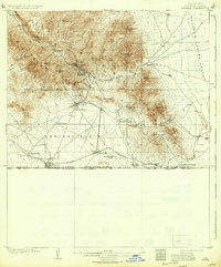
Bisbee and its surrounding mining landscape dominate this 1910 study, revealing the intensive development of the Mule Mountains at the height of the copper boom. The map meticulously documents the transition from the rugged canyons where Brewery Gulch and Tombstone Canyon converge to the open Espinal Plain and Sulphur Spring Valley below. The El Paso and Southwestern RR serves as the industrial spine of the region, connecting the primary townsite with outlying settlements like Don Luis and the border community of Naco on the United States Mexico boundary.
Find a feature on this map
55 named features on this map. Tap any name to fly to it.
Don’t see what you’re looking for? This feature index may not catch every label — zoom into the map to look around manually.
Map Details
Editions of this 1910 Bisbee Map
2 editions found
Other maps of this area

1902 · Bisbee
USGS Topo · 1:62,500

1914 · Hereford
USGS Topo · 1:125,000

1914 · Douglas
USGS Topo · 1:62,500

1915 · Benson
USGS Topo · 1:125,000

1916 · Pearce
USGS Topo · 1:125,000

1916 · Douglas
USGS Topo · 1:125,000

1919 · Douglas
USGS Topo · 1:125,000

1922 · Swisshelm
USGS Topo · 1:62,500

1925 · Douglas
USGS Topo · 1:62,500

1925 · Gleeson
USGS Topo · 1:62,500