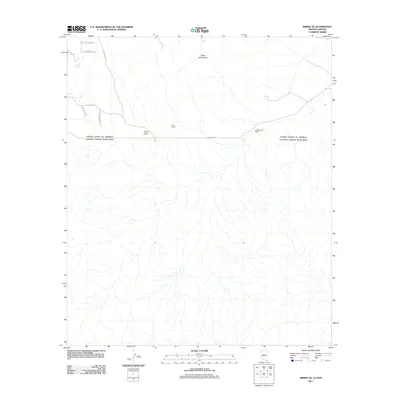
2011 Map of Bisbee SE
USGS Topo · Published 2011About this map
The international border between the United States of America and Estados Unidos Mexicanos defines the central axis of this landscape, where the southern foothills of the Mule Mountains meet the high desert plains. Local landmarks like Christiansen Ranch and the Crook Tunnel offer clues to the ranching and mining history that has long shaped this corner of Arizona and Sonora. The terrain is marked by drainage patterns such as Gold Gulch, which flows southward from the mountains toward the border. Infrastructure is centered around the E Border Rd corridor, with local access provided by a network of smaller routes including S Mesquite Rdg and S Gold Gulch Rd. This survey captures the rural character and topographical detail of the borderlands during the early twenty-first century.
Find a feature on this map
12 named features on this map. Tap any name to fly to it.
Don’t see what you’re looking for? This feature index may not catch every label — zoom into the map to look around manually.
Map Details
Editions of this 2011 Bisbee SE Map
This is the sole edition of this map. No revisions or reprints were ever made.
Other maps of this area

1902 · Bisbee
USGS Topo · 1:62,500

1910 · Bisbee
USGS Topo · 1:62,500

1914 · Douglas
USGS Topo · 1:62,500

1916 · Douglas
USGS Topo · 1:125,000

1919 · Douglas
USGS Topo · 1:125,000

1925 · Douglas
USGS Topo · 1:62,500

1927 · Bisbee
USGS Topo · 1:62,500
1933 · Douglas
USGS Topo · 1:62,500
1933 · Bisbee
USGS Topo · 1:62,500

1955 · Douglas
USGS Topo · 1:250,000