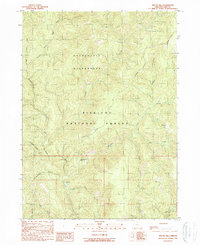
1989 Map of Biscuit Hill
USGS Topo · Published 1989About this map
Siskiyou National Forest and the Kalmiopsis Wilderness define this backcountry landscape at the headwaters of the North Fork Smith River. The topography is dominated by steep drainages like Packsaddle Gulch and the prominent Biscuit Hill near the eastern boundary. This 1989 survey preserves the location of several former human habitations and seasonal outposts, including McKee Cabin (Site), The Oaks (Site), and Diamond Camp (Site). Evidence of early extraction is found at a remote Mine located between Chrome Creek and Spokane Creek. The network of 4wd tracks and trails, such as those near Sourdough Camp, illustrates the limited access to this interior wilderness during the late twentieth century.
Find a feature on this map
25 named features on this map. Tap any name to fly to it.
Don’t see what you’re looking for? This feature index may not catch every label — zoom into the map to look around manually.
Map Details
Editions of this 1989 Biscuit Hill Map
This is the sole edition of this map. No revisions or reprints were ever made.
Other maps of this area

1917 · Kerby
USGS Topo · 1:125,000

1918 · Kerby
USGS Topo · 1:125,000

1922 · Preston Peak
USGS Topo · 1:125,000

1929 · Crescent City
USGS Topo · 1:125,000

1945 · Kerby
USGS Topo · 1:125,000

1945 · Gasquet
USGS Topo · 1:62,500

1945 · Point St. George
USGS Topo · 1:62,500

1948 · Weed
USGS Topo · 1:250,000

1949 · Eureka
USGS Topo · 1:250,000

1950 · Weed
USGS Topo · 1:250,000