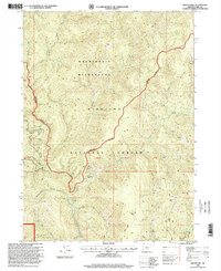
1996 Map of Biscuit Hill
USGS Topo · Published 1999About this map
Kalmiopsis Wilderness dominates this late-twentieth-century landscape, illustrating the rugged backcountry of the Siskiyou National Forest. The map documents a territory defined by deep drainages like Packsaddle Gulch and the North Fork Smith River. Human presence is marked primarily by transitory or historical sites rather than permanent settlements, with several former locations noted such as McKee Cabin (Site) and The Oaks (Site). These labels, along with identified Ruins and a Campsite, point to a history of resource extraction and forest management.
Find a feature on this map
25 named features on this map. Tap any name to fly to it.
Don’t see what you’re looking for? This feature index may not catch every label — zoom into the map to look around manually.
Map Details
Editions of this 1996 Biscuit Hill Map
This is the sole edition of this map. No revisions or reprints were ever made.
Other maps of this area

1917 · Kerby
USGS Topo · 1:125,000

1918 · Kerby
USGS Topo · 1:125,000

1922 · Preston Peak
USGS Topo · 1:125,000

1929 · Crescent City
USGS Topo · 1:125,000

1945 · Kerby
USGS Topo · 1:125,000

1945 · Gasquet
USGS Topo · 1:62,500

1945 · Point St. George
USGS Topo · 1:62,500

1948 · Weed
USGS Topo · 1:250,000

1949 · Eureka
USGS Topo · 1:250,000

1950 · Weed
USGS Topo · 1:250,000