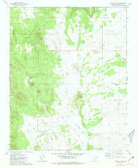
1981 Map of Bishop Lake
USGS Topo · Published 1981About this map
High-altitude basins and critical water management features dominate this Coconino County landscape during the early 1980s. The topography is defined by significant catchments such as Bishop Lake, Tule Lake, and Horse Lake, which appear as seasonal or shallow water bodies essential to the region's hydraulic network. The prevalence of named tanks, including Schafers Tank, Abshires Tank, and Sellers Tank, points to the vital role of these man-made or natural depressions in supporting local ranching and wildlife in an arid environment. A network of primitive roads, including a Jeep Trail, connects these water sources across a terrain marked by subtle shifts in elevation. This survey provides a precise look at the land before modern intensive development, highlighting specific landmarks like Montezuma Lake and Cave Tank that remain central to the area's geography.
Find a feature on this map
10 named features on this map. Tap any name to fly to it.
Don’t see what you’re looking for? This feature index may not catch every label — zoom into the map to look around manually.
Map Details
Editions of this 1981 Bishop Lake Map
This is the sole edition of this map. No revisions or reprints were ever made.
Other maps of this area

1886 · Chino
USGS Topo · 1:250,000

1891 · Chino
USGS Topo · 1:250,000

1948 · Williams
USGS Topo · 1:250,000

1954 · Williams
USGS Topo · 1:250,000

1956 · Williams
USGS Topo · 1:250,000

1960 · Williams
USGS Topo · 1:250,000

1961 · Williams
USGS Topo · 1:250,000
1973 · Mount Floyd
USGS Topo · 1:24,000
1973 · Eagle Nest Mtn
USGS Topo · 1:24,000
1980 · Tin House
USGS Topo · 1:24,000