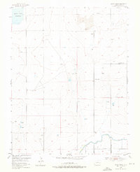
1955 Map of Bishop Ranch
USGS Topo · Published 1976About this map
High plains agriculture and water management define this portion of Bent County, where the Adobe Creek Reservoir sits at the northwestern corner of the quadrangle. The landscape is characterized by a network of vital irrigation infrastructure, most notably the Fort Lyon Canal, which flows along the southern edge alongside a series of levees and unnamed ditches. These water systems supported established homesteads such as Bishop Ranch and the Cordes-Oberlander Ranch, reflecting the settlement patterns of the mid-20th-century Colorado cattle and farming country.
Find a feature on this map
15 named features on this map. Tap any name to fly to it.
Don’t see what you’re looking for? This feature index may not catch every label — zoom into the map to look around manually.
Map Details
Editions of this 1955 Bishop Ranch Map
3 editions found
Other maps of this area

1891 · Las Animas
USGS Topo · 1:125,000

1893 · Las Animas
USGS Topo · 1:125,000

1953 · Las Animas
USGS Topo · 1:24,000

1953 · Cornelia
USGS Topo · 1:24,000

1953 · Kreybill
USGS Topo · 1:24,000

1954 · Lamar
USGS Topo · 1:250,000

1955 · Tree Top Ranch
USGS Topo · 1:24,000

1955 · Mc Intosh Ranch
USGS Topo · 1:24,000

1955 · Bishop Ranch
USGS Topo · 1:24,000

1958 · Lamar
USGS Topo · 1:250,000