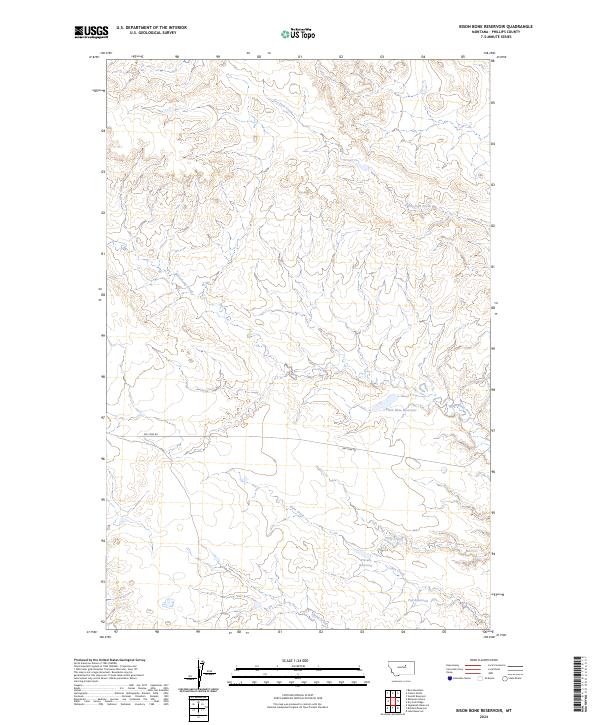
2024 Map of Bison Bone Reservoir
USGS Topo · Published 2024About this map
Bison Bone Reservoir and a series of smaller impoundments like Pep Reservoir and a Private Reservoir define this stretch of the central Montana plains in Phillips County. The landscape is characterized by a high-density network of seasonal drainages, including the branching headwaters of Dry Fork Creek, Beauchamp Creek, and Trine Creek. These watercourses carve through the terrain, illustrating the critical role of water management in this arid ranching environment.
Find a feature on this map
16 named features on this map. Tap any name to fly to it.
Don’t see what you’re looking for? This feature index may not catch every label — zoom into the map to look around manually.
Map Details
Editions of this 2024 Bison Bone Reservoir Map
This is the sole edition of this map. No revisions or reprints were ever made.
Other maps of this area

1954 · Lewistown
USGS Topo · 1:250,000

1959 · Lewistown
USGS Topo · 1:250,000

1965 · Veseth Reservoir
USGS Topo · 1:24,000

1965 · Dry Fork Ridge
USGS Topo · 1:24,000

1965 · Lake Reservoir
USGS Topo · 1:24,000

1971 · Bear Mountain
USGS Topo · 1:24,000

1971 · Robinson School
USGS Topo · 1:24,000

1971 · Bison Bone Reservoir
USGS Topo · 1:24,000
1971 · Coburn Butte
USGS Topo · 1:24,000

1971 · Blizzard Reservoir
USGS Topo · 1:24,000