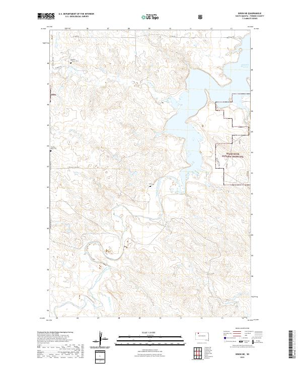
2021 Map of Bison NE
USGS Topo · Published 2021About this map
The South Fork Grand River meanders through this portion of Perkins County, defining a landscape where prairie conservation and water management intersect. Large portions of the eastern terrain are protected as part of the Grand River National Grassland, while the northern reaches include the backwaters of the Shadehill Reservoir. This area reflects a long history of rural settlement, evidenced by a network of section-line roads like White Butte Rd and Pleasant Ridge Rd that connect isolated landmarks. Genealogy researchers will find significant value in the documentation of several remote burial sites, including Rosebud Lutheran Cem, Pleasant Ridge Cem, and the Selm Cem. The drainage patterns of Lodgepole Cr and Butcher Cr illustrate the vital role of water in this expansive South Dakota range land.
Find a feature on this map
20 named features on this map. Tap any name to fly to it.
Don’t see what you’re looking for? This feature index may not catch every label — zoom into the map to look around manually.
Map Details
Editions of this 2021 Bison NE Map
This is the sole edition of this map. No revisions or reprints were ever made.
Other maps of this area

1954 · Lemmon
USGS Topo · 1:250,000

1957 · Lemmon
USGS Topo · 1:250,000

1983 · Haynes SE
USGS Topo · 1:24,000

1983 · Boxcar Buttes
USGS Topo · 1:24,000

1983 · Bison
USGS Topo · 1:24,000

1983 · Bison NE
USGS Topo · 1:24,000

1983 · Meadow NW
USGS Topo · 1:24,000

1983 · Meadow
USGS Topo · 1:24,000

1983 · Bison NW
USGS Topo · 1:24,000
1983 · Sommerville
USGS Topo · 1:24,000