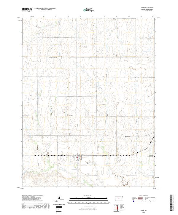
2022 Map of Bison
USGS Topo · Published 2022About this map
Bison serves as the central hub of this Rush County landscape, where the town grid is defined by streets like Main St, Ash Ave, and Pine Ave. The surrounding rural territory is marked by a persistent network of section-line roads, such as Co Rd 584 and Ave M, which provide access to scattered homesteads and agricultural tracts. Waterways including Shelter Cr and Duck Cr meander through the prairie, influencing the local topography and drainage patterns. Cultural and genealogical history is preserved in several rural burial grounds, including Lone Star Cem, the Baptist Cem, and the Seventh-Day Adventist Cem located on the eastern edge of the survey area. This 2022 edition reveals the enduring importance of established township boundaries like t17s r17w and t18s r16w in organizing the central Kansas plains.
Find a feature on this map
38 named features on this map. Tap any name to fly to it.
Don’t see what you’re looking for? This feature index may not catch every label — zoom into the map to look around manually.
Map Details
Editions of this 2022 Bison Map
This is the sole edition of this map. No revisions or reprints were ever made.
Other maps of this area

1889 · Larned
USGS Topo · 1:125,000

1891 · Larned
USGS Topo · 1:125,000

1896 · Hays
USGS Topo · 1:125,000

1955 · Great Bend
USGS Topo · 1:250,000

1957 · Great Bend
USGS Topo · 1:250,000

1958 · Great Bend
USGS Topo · 1:250,000
1965 · Otis
USGS Topo · 1:24,000
1965 · Albert
USGS Topo · 1:24,000

1966 · Rush Center
USGS Topo · 1:24,000

1966 · La Crosse
USGS Topo · 1:24,000