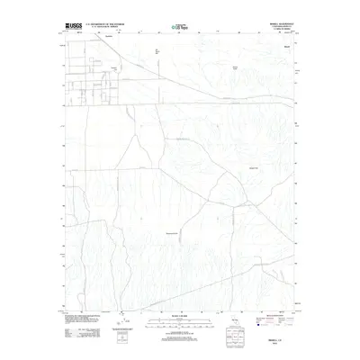
2012 Map of Bissell
USGS Topo · Published 2012About this map
Sanborn and Bissell anchor this high-desert landscape in Kern County during the early 21st century, where the grid of local development meets the extensive footprint of Edwards Air Force Sta. The terrain is defined by isolated peaks and ridges like Lookout Hill, Brown Butte, and De Stazo Hill, providing a stark contrast to the rectilinear road network. Long thoroughfares such as Mojave Blvd and E Sopp Rd cut across the arid landscape, connecting these small settlements to the broader region. The southeastern portion of the sheet is dominated by the complex topography of the Bissell Hills and Rosamond Hills, illustrating the geological character of the Mojave. This survey documents the intersection of military infrastructure and local habitation at a time of continued regional presence.
Find a feature on this map
17 named features on this map. Tap any name to fly to it.
Don’t see what you’re looking for? This feature index may not catch every label — zoom into the map to look around manually.
Map Details
Editions of this 2012 Bissell Map
This is the sole edition of this map. No revisions or reprints were ever made.
Other maps of this area

1915 · Elizabeth Lake
USGS Topo · 1:125,000

1915 · Searles Lake
USGS Topo · 1:250,000

1915 · Mojave
USGS Topo · 1:125,000

1917 · Elizabeth Lake
USGS Topo · 1:125,000

1937 · Rogers Lake
USGS Topo · 1:48,000

1942 · Rogers Lake
USGS Topo · 1:62,500

1943 · Rosamond
USGS Topo · 1:62,500

1943 · Castle Butte
USGS Topo · 1:62,500

1943 · Mojave
USGS Topo · 1:62,500

1947 · Fluhr
USGS Topo · 1:24,000