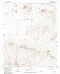
1973 Map of Bissell
USGS Topo · Published 1985About this map
Edwards Air Force Base dominates the southern landscape of this high desert terrain, where the Air Force Test Center and various military reservation boundaries underscore the region's importance to national defense during the 1970s. The northern reaches are defined by the tracks of the Atchison Topeka and Santa Fe railroad, which passes near the small settlement of Bissell. The topography is marked by distinctive formations including De Stazo Hill, Lookout Hill, and Brown Butte, rising above the surrounding flats. Military and industrial infrastructure is visible throughout, including a Radio Facility, several Radio Tower sites, and a designated Target. These features, along with scattered Mine and Prospect locations, reflect a landscape utilized for both tactical training and resource extraction in Kern County.
Find a feature on this map
22 named features on this map. Tap any name to fly to it.
Don’t see what you’re looking for? This feature index may not catch every label — zoom into the map to look around manually.
Map Details
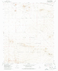
Editions of this 1973 Bissell Map
2 editions found
Other maps of this area

1915 · Elizabeth Lake
USGS Topo · 1:125,000

1915 · Searles Lake
USGS Topo · 1:250,000

1915 · Mojave
USGS Topo · 1:125,000

1917 · Elizabeth Lake
USGS Topo · 1:125,000

1937 · Rogers Lake
USGS Topo · 1:48,000

1942 · Rogers Lake
USGS Topo · 1:62,500

1943 · Rosamond
USGS Topo · 1:62,500

1943 · Castle Butte
USGS Topo · 1:62,500

1943 · Mojave
USGS Topo · 1:62,500

1947 · Fluhr
USGS Topo · 1:24,000