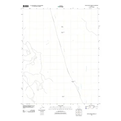
2011 Map of Bitter Creek Divide
USGS Topo · Published 2011About this map
Strike Valley Overlook and Oyster Shell Reef anchor the southern reach of this desert corridor, where the land transitions through the Bitter Creek Divide. The landscape is defined by its drainage systems, including Sandy Creek, Halls Creek, and Bitter Spring Creek, which carve through the arid terrain of Garfield County. This 2011 survey captures the primitive infrastructure of the region, specifically the winding route of the Capitol Reef National Park Rd and the Burr Trl. The map illustrates a dramatic geological environment where named features like Divide Canyon provide reference points in an area largely defined by its natural topography rather than human settlement. The placement of these roads relative to the creeks highlights the limited access points into this part of the Colorado Plateau.
Find a feature on this map
11 named features on this map. Tap any name to fly to it.
Don’t see what you’re looking for? This feature index may not catch every label — zoom into the map to look around manually.
Map Details
Editions of this 2011 Bitter Creek Divide Map
This is the sole edition of this map. No revisions or reprints were ever made.
Other maps of this area

1885 · San Rafael
USGS Topo · 1:250,000

1885 · Fish Lake
USGS Topo · 1:250,000

1886 · Escalante
USGS Topo · 1:250,000

1886 · Henry Mountains
USGS Topo · 1:250,000

1892 · Henry Mountains
USGS Topo · 1:250,000

1896 · Fish Lake
USGS Topo · 1:250,000

1952 · Notom 4 SE
USGS Topo · 1:24,000

1952 · Notom 4 SW
USGS Topo · 1:24,000

1952 · Notom
USGS Topo · 1:62,500

1953 · Mt Pennell
USGS Topo · 1:62,500