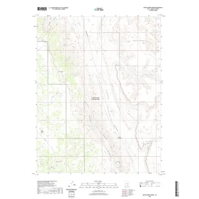
2020 Map of Bitter Creek Divide
USGS Topo · Published 2020About this map
Capitol Reef National Park and the surrounding Garfield County landscape are defined by striking geological formations and isolated water sources. The transition from the Circle Cliffs in the west to the deeply carved Grand Gulch and Halls Cr in the east illustrates the complex erosional history of the region. Notable landmarks like the Oyster Shell Reef and Tarantula Mesa overlook a network of seasonal drainages, including Bitter Cr and Sandy Cr. Remote transportation routes such as the Notom-Bullfrog Road and Burr Trl follow natural contours, providing access to vantage points like the Strike Valley Overlook. Smaller features, such as Onion Flats Seep and Studhorse Peaks, highlight specific locales within the broader expanse of White Canyon Flat and Divide Canyon.
Find a feature on this map
21 named features on this map. Tap any name to fly to it.
Don’t see what you’re looking for? This feature index may not catch every label — zoom into the map to look around manually.
Map Details
Editions of this 2020 Bitter Creek Divide Map
This is the sole edition of this map. No revisions or reprints were ever made.
Other maps of this area

1885 · San Rafael
USGS Topo · 1:250,000

1885 · Fish Lake
USGS Topo · 1:250,000

1886 · Escalante
USGS Topo · 1:250,000

1886 · Henry Mountains
USGS Topo · 1:250,000

1892 · Henry Mountains
USGS Topo · 1:250,000

1896 · Fish Lake
USGS Topo · 1:250,000

1952 · Notom 4 SE
USGS Topo · 1:24,000

1952 · Notom 4 SW
USGS Topo · 1:24,000

1952 · Notom
USGS Topo · 1:62,500

1953 · Mt Pennell
USGS Topo · 1:62,500