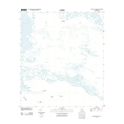
2012 Map of Black Bay North
USGS Topo · Published 2012About this map
North Black Bay Oil and Gas Field and the Lake Campo Gas Field anchor the southern reaches of this intricate marshland landscape in Saint Bernard Parish. The terrain is defined by a complex network of coastal waterways, where the waters of Lake Jean Louis Robin and the Lake of Second Trees meet a fragmented shoreline of named points and islands. This area, largely inaccessible by road, shows the heavy footprint of energy extraction within the delicate Mississippi River Delta ecosystem, marked by several prominent oil and gas fields.
Find a feature on this map
21 named features on this map. Tap any name to fly to it.
Don’t see what you’re looking for? This feature index may not catch every label — zoom into the map to look around manually.
Map Details
Editions of this 2012 Black Bay North Map
This is the sole edition of this map. No revisions or reprints were ever made.
Other maps of this area

1893 · La Fortuna
USGS Topo · 1:62,500

1893 · Shell Beach
USGS Topo · 1:62,500

1893 · Dime
USGS Topo · 1:62,500

1895 · Bodreau
USGS Topo · 1:62,500

1935 · Lake Athanasio
USGS Topo · 1:31,680

1935 · Lake Calebasse
USGS Topo · 1:31,680

1939 · Shell Beach
USGS Topo · 1:62,500

1941 · Black Bay
USGS Topo · 1:62,500

1941 · Shell Beach
USGS Topo · 1:62,500
1944 · Black Bay
USGS Topo · 1:62,500