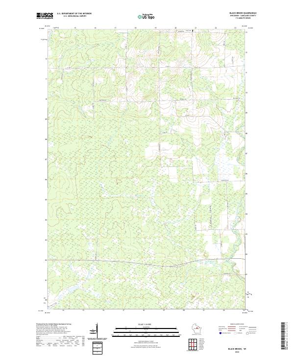
2022 Map of Black Brook
USGS Topo · Published 2022About this map
Peck Cem sits along the northern boundary of this Langlade County landscape, a marker of early local history amid a dense network of watercourses and forest lands. The terrain is defined by the southward flow of the West Branch Eau Claire River and its interaction with Black Brook, creating a complex system of wetlands and small tributaries like Lloyd Cr and the Popple River.
Find a feature on this map
32 named features on this map. Tap any name to fly to it.
Don’t see what you’re looking for? This feature index may not catch every label — zoom into the map to look around manually.
Map Details
Editions of this 2022 Black Brook Map
This is the sole edition of this map. No revisions or reprints were ever made.
Other maps of this area

1899 · Wausau
USGS Topo · 1:125,000

1902 · Wausau
USGS Topo · 1:125,000

1940 · Parrish
USGS Topo · 1:48,000

1942 · Elcho
USGS Topo · 1:48,000

1950 · Elcho
USGS Topo · 1:48,000

1950 · Parrish
USGS Topo · 1:48,000

1951 · Doering
USGS Topo · 1:48,000

1952 · Parrish
USGS Topo · 1:48,000

1952 · Antigo
USGS Topo · 1:48,000

1954 · Iron Mountain
USGS Topo · 1:250,000