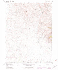
1967 Map of Black Butte
USGS Topo · Published 1983About this map
Black Butte rises as a prominent landmark in this high-desert landscape of Elko County, photographed in 1966 and updated through the early 1980s. The terrain is defined by a sparse but vital water network, including Burnt Creek and Greek Creek, which cut through the drainage basins of the high country. To the south, Antelope Springs and Trout Creek provided essential water points for cattle and wildlife. The map reveals the rudimentary infrastructure of the era, consisting almost entirely of a network of Jeep Trails that provided access to the backcountry. A solitary Gravel Pit near the center of the sheet indicates small-scale local resource extraction, likely for the maintenance of these remote routes during a period when this region remained largely untouched by major development.
Find a feature on this map
11 named features on this map. Tap any name to fly to it.
Don’t see what you’re looking for? This feature index may not catch every label — zoom into the map to look around manually.
Map Details
Editions of this 1967 Black Butte Map
3 editions found
Other maps of this area

1955 · Wells
USGS Topo · 1:250,000

1958 · Wells
USGS Topo · 1:250,000

1961 · Wells
USGS Topo · 1:250,000

1967 · Black Butte SW
USGS Topo · 1:24,000

1967 · Black Butte
USGS Topo · 1:24,000

1967 · Buena Vista Ranch
USGS Topo · 1:24,000

1967 · Black Butte NE
USGS Topo · 1:24,000

1967 · Metropolis
USGS Topo · 1:24,000
1967 · Tabor Flats
USGS Topo · 1:24,000

1968 · Summer Camp
USGS Topo · 1:24,000