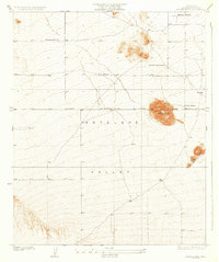
1933 Map of Black Butte
USGS Topo · Published 1933About this map
Antelope Valley dominates this 1930s landscape, a time when isolated homesteads and ranching outposts defined the character of northeastern Los Angeles County. The high desert terrain is punctuated by volcanic features like Black Butte and the distinctive chain of hills known as the Three Sisters. At the time of this survey, the region was sparsely populated, with life centered around family-held operations such as Hibbard Ranch, Morrison Ranch, and Vanderburg Ranch. The map captures the geometric precision of the First Standard Parallel North, showing how early surveyors imposed order on the scrubland. This document offers a window into the transition of the California desert before mid-century development, recording the exact placement of windmills, tanks, and tracks that served these early twentieth-century settlers near Brase Ranch.
Find a feature on this map
8 named features on this map. Tap any name to fly to it.
Don’t see what you’re looking for? This feature index may not catch every label — zoom into the map to look around manually.
Map Details
Editions of this 1933 Black Butte Map
2 editions found

Other maps of this area

1901 · Southern California Sheet No. 1
USGS Topo · 1:250,000

1903 · Rock Creek
USGS Topo · 1:62,500

1903 · San Antonio
USGS Topo · 1:62,500

1904 · Southern California Sheet No. 1
USGS Topo · 1:250,000

1930 · Lovejoy Springs
USGS Topo · 1:24,000

1930 · Black Butte
USGS Topo · 1:24,000

1930 · El Mirage
USGS Topo · 1:24,000

1930 · Llano
USGS Topo · 1:24,000

1930 · Angle
USGS Topo · 1:24,000

1930 · Wilsona
USGS Topo · 1:24,000