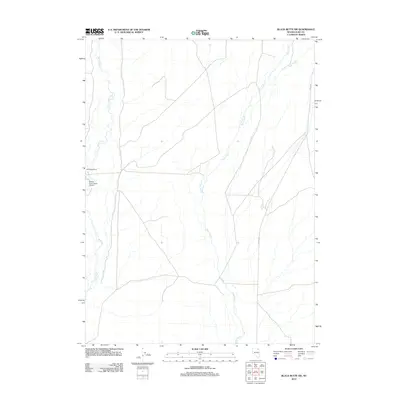
2012 Map of Black Butte SW
USGS Topo · Published 2012About this map
The Marys River and Tabor Creek converge in this high desert landscape of Elko County, defining a region where water availability dictates human activity. At the center of this ranching environment sits the Mala Vista Ranch, a testament to the isolated livestock operations that characterize this part of Nevada. Near the western edge of the map, the Marys River Ranch Airport provides a critical aerial link for this remote area, where vast distances are often traversed by air or via unpaved routes like Co RD 753. The drainage patterns of Pole Creek and various unnamed tributaries illustrate the intricate hydrological network feeding into the larger river system, which remains the primary focal point for both navigation and settlement in this portion of the Great Basin.
Find a feature on this map
7 named features on this map. Tap any name to fly to it.
Don’t see what you’re looking for? This feature index may not catch every label — zoom into the map to look around manually.
Map Details
Editions of this 2012 Black Butte SW Map
This is the sole edition of this map. No revisions or reprints were ever made.
Other maps of this area

1955 · Wells
USGS Topo · 1:250,000

1958 · Wells
USGS Topo · 1:250,000

1961 · Wells
USGS Topo · 1:250,000

1967 · Black Butte SW
USGS Topo · 1:24,000

1967 · Black Butte
USGS Topo · 1:24,000

1967 · Hot Springs Creek
USGS Topo · 1:24,000

1967 · Twin Buttes
USGS Topo · 1:24,000

1967 · Buena Vista Ranch
USGS Topo · 1:24,000

1967 · Black Butte NE
USGS Topo · 1:24,000

1967 · Hanks Creek NE
USGS Topo · 1:24,000