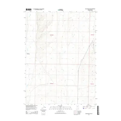
2014 Map of Black Butte SW
USGS Topo · Published 2014About this map
Marys River winds through this High Desert landscape of Elko County, defining a drainage basin that also includes Tabor Cr and Pole Cr. The map captures a transition in the eastern Nevada ranching country as it appeared in 2014, where infrastructure is sparse but critical to the vast rangelands. The Marys River Ranch Airport provides a rare landmark in the western portion of the sheet, indicating the scale of these remote operations where air travel is a practical necessity for remote land management. Secondary roads CR-753 and CR-754 navigate the eastern terrain, following the natural contours of the basin. The Public Land Survey System grid lines for t40n r60e and surrounding townships offer a clear view of how these interior basins are organized for grazing and water rights in a region where every stream is a vital resource.
Find a feature on this map
10 named features on this map. Tap any name to fly to it.
Don’t see what you’re looking for? This feature index may not catch every label — zoom into the map to look around manually.
Map Details
Editions of this 2014 Black Butte SW Map
This is the sole edition of this map. No revisions or reprints were ever made.
Other maps of this area

1955 · Wells
USGS Topo · 1:250,000

1958 · Wells
USGS Topo · 1:250,000

1961 · Wells
USGS Topo · 1:250,000

1967 · Black Butte SW
USGS Topo · 1:24,000

1967 · Black Butte
USGS Topo · 1:24,000

1967 · Hot Springs Creek
USGS Topo · 1:24,000

1967 · Twin Buttes
USGS Topo · 1:24,000

1967 · Buena Vista Ranch
USGS Topo · 1:24,000

1967 · Black Butte NE
USGS Topo · 1:24,000

1967 · Hanks Creek NE
USGS Topo · 1:24,000