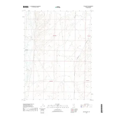
2018 Map of Black Butte SW
USGS Topo · Published 2018About this map
Marys River meanders through this portion of Elko County, defining a wide riparian corridor in an otherwise arid high-desert landscape. The area is characterized by low relief and drainage networks that feed into the river, including Pole Cr and Tabor Cr. Human activity is centered on the Marys River Ranch Airport, indicating the importance of private aviation for accessing and managing large ranching tracts in this part of northeastern Nevada. Transportation is facilitated by the O'Neil-Deeth Co Rd, which provides a primary transit link through the eastern half of the map. The spatial arrangement of these features suggests a landscape dedicated to large-scale livestock operations, where natural water sources and remote access points are critical for economic viability.
Find a feature on this map
9 named features on this map. Tap any name to fly to it.
Don’t see what you’re looking for? This feature index may not catch every label — zoom into the map to look around manually.
Map Details
Editions of this 2018 Black Butte SW Map
This is the sole edition of this map. No revisions or reprints were ever made.
Other maps of this area

1955 · Wells
USGS Topo · 1:250,000

1958 · Wells
USGS Topo · 1:250,000

1961 · Wells
USGS Topo · 1:250,000

1967 · Black Butte SW
USGS Topo · 1:24,000

1967 · Black Butte
USGS Topo · 1:24,000

1967 · Hot Springs Creek
USGS Topo · 1:24,000

1967 · Twin Buttes
USGS Topo · 1:24,000

1967 · Buena Vista Ranch
USGS Topo · 1:24,000

1967 · Black Butte NE
USGS Topo · 1:24,000

1967 · Hanks Creek NE
USGS Topo · 1:24,000