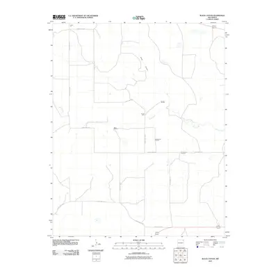
2010 Map of Black Canyon
USGS Topo · Published 2010About this map
Black Canyon cuts through the high plains of Union County in this 2010 topographic survey, revealing a landscape defined by ranching infrastructure and intermittent watercourses. The drainage of Perico Creek meanders across the territory, punctuated by essential water sources for livestock such as the Rummel Windmill, Myers Windmill, and Bull Pasture Windmill. The presence of the Schoolhouse Windmill suggests the locations of earlier rural community hubs in this sparsely populated region of northeastern New Mexico. Aside from the Heringa Ranch, the area is primarily navigated via a grid of regional routes, including County Hwy A-035 and County Hwy A-018. This survey provides a precise look at the land usage in the early 21st century, where industrial features like the Jones Pit exist alongside traditional grazing lands.
Find a feature on this map
17 named features on this map. Tap any name to fly to it.
Don’t see what you’re looking for? This feature index may not catch every label — zoom into the map to look around manually.
Map Details
Editions of this 2010 Black Canyon Map
This is the sole edition of this map. No revisions or reprints were ever made.
Other maps of this area

1954 · Dalhart
USGS Topo · 1:250,000

1958 · Dalhart
USGS Topo · 1:250,000

1962 · Dalhart
USGS Topo · 1:250,000

1966 · Royce
USGS Topo · 1:24,000

1966 · Black Canyon
USGS Topo · 1:24,000

1966 · Tate School
USGS Topo · 1:24,000

1966 · Sand Hill
USGS Topo · 1:24,000

1972 · Mount Dora
USGS Topo · 1:24,000

1972 · Bible Top Butte
USGS Topo · 1:24,000

1973 · Snyder Lake
USGS Topo · 1:24,000