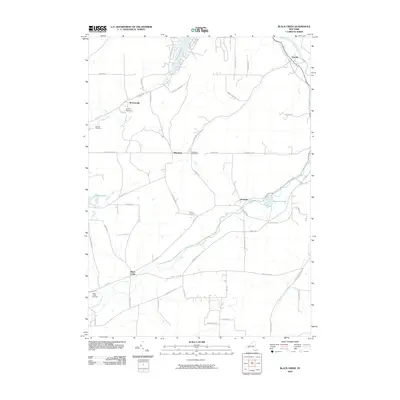
2010 Map of Black Creek
USGS Topo · Published 2010About this map
Oramel and the upper reaches of the Genesee River anchor the northeastern corner of this Allegany County landscape, where small hamlets are connected by a network of rural roads and watercourses. The settlement at Black Creek serves as a primary hub in the south, positioned near its namesake waterway and the Black Creek Cemetery. To the north, the waters of Rushford Lake and Rush Creek define the local topography, with Camp Rushford situated near the community of McGrawville. The area's genealogical history is well-represented through several localized burial grounds, including Marshall Cemetery and Sayers Cemetery. The terrain is characterized by distinctive features such as the Hanging Bog and Rockville Lake, reflecting a landscape defined more by its natural hydrology and small-scale settlements than by industrial development. This 2010 survey provides a clear view of the longstanding road patterns like Punkey Hollow Rd and Federal Rd that continue to link these western New York communities.
Find a feature on this map
56 named features on this map. Tap any name to fly to it.
Don’t see what you’re looking for? This feature index may not catch every label — zoom into the map to look around manually.
Map Details
Editions of this 2010 Black Creek Map
This is the sole edition of this map. No revisions or reprints were ever made.
Other maps of this area

1898 · Olean
USGS Topo · 1:62,500

1906 · Angelica
USGS Topo · 1:62,500

1924 · Franklinville
USGS Topo · 1:62,500

1925 · Belmont
USGS Topo · 1:62,500

1938 · Olean
USGS Topo · 1:62,500

1939 · Belmont
USGS Topo · 1:62,500

1941 · Angelica
USGS Topo · 1:62,500

1942 · Franklinville
USGS Topo · 1:62,500

1943 · Olean
USGS Topo · 1:62,500

1960 · Buffalo
USGS Topo · 1:250,000