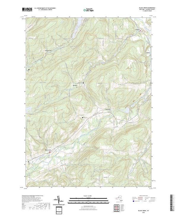
2023 Map of Black Creek
USGS Topo · Published 2023About this map
Black Creek flows through the heart of this Allegany County landscape, tracing a valley that historically supported the path of the Genesee Valley Canal. This 2023 survey illustrates a rural New York geography defined by its upland ridges and narrow stream corridors. Settlement patterns remain concentrated in small hamlets like Oramel, Belfast, and the namesake village of Black Creek, while higher elevations such as McNamara Hill and Barber Hill are accessed by a network of winding roads like Taylor Hill Rd and Vreeland Hill Rd. Genealogists will find several documented burial grounds, including Bellville Cem, Marshall Cem, and Sayers Cem, which provide specific points of interest for family history research. The presence of the Genesee River in the northeastern corner further anchors the area's topographical and economic identity within the broader Genesee Valley region.
Find a feature on this map
65 named features on this map. Tap any name to fly to it.
Don’t see what you’re looking for? This feature index may not catch every label — zoom into the map to look around manually.
Map Details
Editions of this 2023 Black Creek Map
This is the sole edition of this map. No revisions or reprints were ever made.
Other maps of this area

1898 · Olean
USGS Topo · 1:62,500

1906 · Angelica
USGS Topo · 1:62,500

1924 · Franklinville
USGS Topo · 1:62,500

1925 · Belmont
USGS Topo · 1:62,500

1938 · Olean
USGS Topo · 1:62,500

1939 · Belmont
USGS Topo · 1:62,500

1941 · Angelica
USGS Topo · 1:62,500

1942 · Franklinville
USGS Topo · 1:62,500

1943 · Olean
USGS Topo · 1:62,500

1960 · Buffalo
USGS Topo · 1:250,000