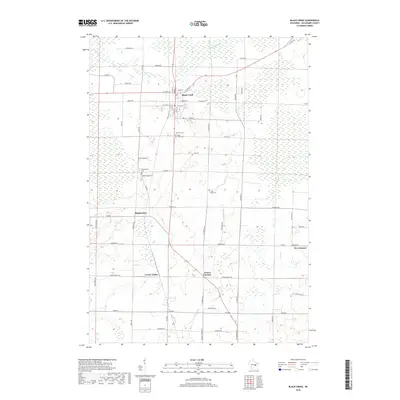
2018 Map of Black Creek
USGS Topo · Published 2018About this map
Black Creek serves as the primary hub of this Outagamie County landscape, characterized by a grid of agricultural roads and several historic rural intersections. The map highlights the localized settlement patterns of early Wisconsin townships, where small clusters like Binghamton, Twelve Corners, and Five Corners emerged around key crossroads. For genealogists, the map is particularly valuable for its documentation of several community burial sites, including the Sassman Cem, Black Creek Cem, and Saint Petri Cem. The terrain is defined by the winding paths of Black Creek and Duck Creek, which traverse the low-lying areas. This contemporary survey captures the enduring rural character of the region, where legacy farm roads like Stingle Rd and Krueger Rd continue to connect long-established homesteads and small communities such as Center Valley.
Find a feature on this map
58 named features on this map. Tap any name to fly to it.
Don’t see what you’re looking for? This feature index may not catch every label — zoom into the map to look around manually.
Map Details
Editions of this 2018 Black Creek Map
This is the sole edition of this map. No revisions or reprints were ever made.
Other maps of this area

1955 · Embarrass
USGS Topo · 1:48,000

1955 · Appleton
USGS Topo · 1:24,000

1955 · Appleton
USGS Topo · 1:62,500

1955 · Seymour
USGS Topo · 1:62,500

1955 · Green Bay
USGS Topo · 1:250,000

1956 · New London
USGS Topo · 1:48,000

1969 · Leeman
USGS Topo · 1:24,000
1969 · Greenville
USGS Topo · 1:24,000
1969 · Shiocton
USGS Topo · 1:24,000

1974 · Seymour
USGS Topo · 1:24,000