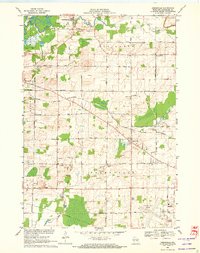
1969 Map of Greenville
USGS Topo · Published 1972About this map
The Wolf River and Bear Creek define the northern landscape of Outagamie County in this late 1960s survey, where the small settlements of Stephensville, Hortonville, and Greenville serve as hubs for a largely agricultural and industrial region. The Chicago and North Western railroad cuts diagonally across the terrain, passing through the village of Greenville and past landmarks like the Wayside Park. Genealogists will find significant value in the detailed identification of local cemeteries and churches, including St Patricks Cem and Immanuel Ch Cem, alongside rural educational landmarks like the Wide Awake Sch. The southern portion of the map highlights the infrastructure of the Outagamie County Airport and the numerous gravel pits and sandpits that reflect the local extractive industry. This map documents a period of steady growth, evidenced by the transition from rural township roads to the expansion of the airport and corporate boundaries.
Find a feature on this map
59 named features on this map. Tap any name to fly to it.
Don’t see what you’re looking for? This feature index may not catch every label — zoom into the map to look around manually.
Map Details
Editions of this 1969 Greenville Map
2 editions found
Other maps of this area

1911 · Neenah
USGS Topo · 1:62,500

1955 · Neenah
USGS Topo · 1:62,500

1955 · Appleton
USGS Topo · 1:24,000

1955 · Appleton
USGS Topo · 1:62,500

1955 · Neenah
USGS Topo · 1:24,000

1955 · Green Bay
USGS Topo · 1:250,000

1956 · New London
USGS Topo · 1:48,000

1961 · Oshkosh
USGS Topo · 1:62,500

1961 · Oshkosh NE
USGS Topo · 1:24,000

1961 · Oshkosh NW
USGS Topo · 1:24,000