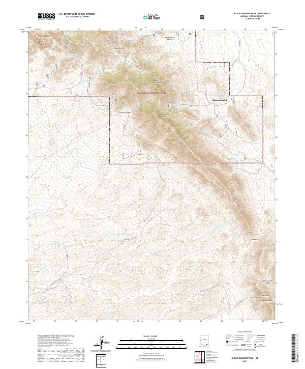
2021 Map of Black Diamond Peak
USGS Topo · Published 2021About this map
Coronado National Forest dominates the upper half of this topographic survey, centered on the high elevations of the Dragoon Mountains. The landscape is defined by its water-management features and rugged terrain transitions, with Black Diamond Peak serving as a primary landmark. Settlement is sparse, with Black Diamond and its associated infrastructure like the Black Diamond Tank marking the historical human presence in these high-desert mountains. The surveying of natural springs, including Walnut Springs, Majo Spring, and Caslink Spring, highlights the critical importance of water sources in this arid region. To the south, the terrain opens into deep drainages and named passes, including Middlemarch Pass and South Pass, which have historically dictated movement through the range. Local history is etched into the names of the landscape, from Dead Mexican Canyon to the curiously named OK Notch and Stockton Draw.
Find a feature on this map
41 named features on this map. Tap any name to fly to it.
Don’t see what you’re looking for? This feature index may not catch every label — zoom into the map to look around manually.
Map Details
Editions of this 2021 Black Diamond Peak Map
This is the sole edition of this map. No revisions or reprints were ever made.
Other maps of this area

1915 · Benson
USGS Topo · 1:125,000

1916 · Pearce
USGS Topo · 1:125,000

1922 · St. David
USGS Topo · 1:62,500

1925 · Gleeson
USGS Topo · 1:62,500

1926 · Courtland
USGS Topo · 1:62,500

1932 · Fairbank
USGS Topo · 1:62,500

1943 · Benson
USGS Topo · 1:125,000
1952 · Tombstone
USGS Topo · 1:24,000
1952 · Tombstone
USGS Topo · 1:62,500

1955 · Douglas
USGS Topo · 1:250,000