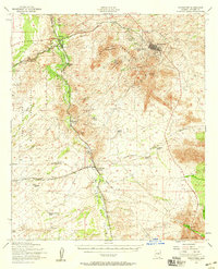
1952 Map of Tombstone
USGS Topo · Published 1959About this map
Tombstone and its surrounding hills dominate the eastern landscape in this 1952 survey, showcasing the enduring remnants of the region's mining and frontier history. The legendary Boothill Cem and the Schieffelin Mon stand as monuments to the town's storied past, while Comstock Hill and the Charleston Lead Mine indicate the mineral wealth that once fueled the area. The map illustrates a network of ranching life through family holdings such as Boquillas Ranch, Guthrie Ranch, and Lucky Hills Ranch, alongside the riparian corridor of the San Pedro River. Transportation patterns are clearly defined by the Southern Pacific tracks and an Old RR Grade, marking the transition from early steam-powered logistics to a mid-century infrastructure that includes the Tombstone Airfield and the northern edge of the Mule Mts. The presence of the Fort Huachuca Military Reservation further emphasizes the strategic importance of the San Pedro Valley.
Find a feature on this map
41 named features on this map. Tap any name to fly to it.
Don’t see what you’re looking for? This feature index may not catch every label — zoom into the map to look around manually.
Map Details
Editions of this 1952 Tombstone Map
2 editions found
Other maps of this area

1902 · Bisbee
USGS Topo · 1:62,500

1910 · Bisbee
USGS Topo · 1:62,500

1914 · Hereford
USGS Topo · 1:125,000

1915 · Benson
USGS Topo · 1:125,000

1916 · Pearce
USGS Topo · 1:125,000

1916 · Douglas
USGS Topo · 1:125,000

1919 · Douglas
USGS Topo · 1:125,000

1922 · Sunnyside
USGS Topo · 1:62,500

1922 · St. David
USGS Topo · 1:62,500

1925 · Gleeson
USGS Topo · 1:62,500