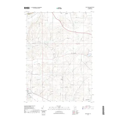
2018 Map of Black Earth
USGS Topo · Published 2018About this map
Black Earth and Cross Plains anchor the southern edge of this West Madison-area landscape, where the driftless terrain transitions into significant geological formations. The elevation rises sharply toward Table Bluff, a prominent landform overlooking the surrounding valleys. A high density of rural cemeteries, including Old Black Earth Cem and Saint John's Lutheran Church Cem, suggests a long-standing settlement pattern rooted in small farming communities. The northern reaches are defined by Roxbury and the drainage of Dunlap Cr, while the central valley is home to Marxville and Halfway Prairie Cr. Modern conservation and recreation are represented by the Ice Age National Scenic Trail, which winds through the glacial topography south of Table Bluff Rd. This 2018 survey documents the persistent rural character of these Dane County townships, where family-named roads like Beuthin Rd and Schuman Rd continue to mark the local geography.
Find a feature on this map
79 named features on this map. Tap any name to fly to it.
Don’t see what you’re looking for? This feature index may not catch every label — zoom into the map to look around manually.
Map Details
Editions of this 2018 Black Earth Map
This is the sole edition of this map. No revisions or reprints were ever made.
Other maps of this area

1895 · Baraboo
USGS Topo · 1:62,500

1901 · Denzer
USGS Topo · 1:62,500

1907 · Cross Plains
USGS Topo · 1:62,500

1908 · Baraboo
USGS Topo · 1:62,500

1909 · Cross Plains
USGS Topo · 1:62,500

1920 · Blue Mounds
USGS Topo · 1:62,500

1922 · Blue Mounds
USGS Topo · 1:62,500

1957 · Madison
USGS Topo · 1:250,000

1958 · North Freedom
USGS Topo · 1:62,500

1959 · Baraboo
USGS Topo · 1:62,500