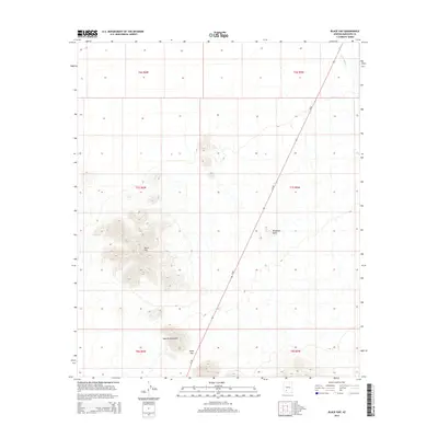
2014 Map of Black Gap
USGS Topo · Published 2014About this map
The White Hills and the rugged northern reaches of the Sauceda Mountains define this arid landscape in southwestern Arizona. This 2014 survey documents a sparsely settled region dominated by geological formations and desert drainage systems. A primary transit corridor, Az-85, cuts a straight diagonal through the eastern half of the map, providing the only major modernized infrastructure through the basin. The topographic detail reveals the namesake Black Gap, a narrow passage through the mountainous terrain that has historically dictated movement through this part of Maricopa County. Natural features like Blindman Butte and the ephemeral Sauceda Wash illustrate the complex drainage patterns characteristic of the Sonoran Desert, where water follows ancient paths through the volcanic and sedimentary ridges.
Find a feature on this map
12 named features on this map. Tap any name to fly to it.
Don’t see what you’re looking for? This feature index may not catch every label — zoom into the map to look around manually.
Map Details
Editions of this 2014 Black Gap Map
This is the sole edition of this map. No revisions or reprints were ever made.
Other maps of this area

1950 · Theba
USGS Topo · 1:62,500

1951 · Gila Bend
USGS Topo · 1:62,500

1951 · Theba
USGS Topo · 1:62,500

1953 · Ajo
USGS Topo · 1:250,000

1957 · Ajo
USGS Topo · 1:250,000

1958 · Ajo
USGS Topo · 1:250,000

1958 · Midway
USGS Topo · 1:62,500

1958 · Hat Mountain
USGS Topo · 1:62,500

1962 · Ajo
USGS Topo · 1:250,000

1963 · Ajo
USGS Topo · 1:250,000