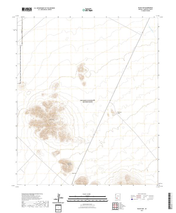
2021 Map of Black Gap
USGS Topo · Published 2021About this map
The White Hills dominate the western portion of this desert landscape in southern Maricopa County, providing a stark topographical contrast to the surrounding basins. This contemporary survey by the U.S. Geological Survey illustrates a region defined by its rugged elevations and drainage systems, including the Sauceda Wash in the northeast and the northern reaches of the Sauceda Mountains at the southern border. The terrain is bisected by Route 85, which passes through the geographic notch of Black Gap and runs parallel to Blindman Butte. The map details the Public Land Survey System grid across multiple townships and ranges, while maintaining focus on the natural landmarks and sparse transportation corridors like S Potatoe Rd that serve this arid environment.
Find a feature on this map
13 named features on this map. Tap any name to fly to it.
Don’t see what you’re looking for? This feature index may not catch every label — zoom into the map to look around manually.
Map Details
Editions of this 2021 Black Gap Map
This is the sole edition of this map. No revisions or reprints were ever made.
Other maps of this area

1950 · Theba
USGS Topo · 1:62,500

1951 · Gila Bend
USGS Topo · 1:62,500

1951 · Theba
USGS Topo · 1:62,500

1953 · Ajo
USGS Topo · 1:250,000

1957 · Ajo
USGS Topo · 1:250,000

1958 · Ajo
USGS Topo · 1:250,000

1958 · Midway
USGS Topo · 1:62,500

1958 · Hat Mountain
USGS Topo · 1:62,500

1962 · Ajo
USGS Topo · 1:250,000

1963 · Ajo
USGS Topo · 1:250,000