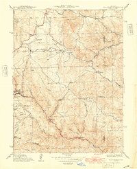
1948 Map of Black Hawk
USGS Topo · Published 1948About this map
Mining heritage and complex Front Range topography define this 1940s survey of the Gilpin County gold districts. Centered on the narrow canyons of North Clear Creek, the map details the high-altitude urban footprints of Black Hawk and neighboring Central City during a period of postwar transition. The landscape is a dense network of gulches and family-named landmarks, such as Justice Hill and Banta Hill, reflecting decades of intensive prospecting and settlement. Away from the primary towns, the map traces the vital infrastructure of the era, including the Golden Gate Canyon Road and remote educational outposts like the Mountain House Sch and Bay State Sch. The southern reaches show active extraction sites like the Summit Mine, while the northern area transitions into the timbered slopes of the Roosevelt National Forest and Arapaho National Forest.
Find a feature on this map
41 named features on this map. Tap any name to fly to it.
Don’t see what you’re looking for? This feature index may not catch every label — zoom into the map to look around manually.
Map Details
Editions of this 1948 Black Hawk Map
This is the sole edition of this map. No revisions or reprints were ever made.
Other maps of this area

1899 · West Denver
USGS Topo · 1:125,000

1903 · Georgetown
USGS Topo · 1:62,500

1905 · Central City
USGS Topo · 1:62,500

1905 · Georgetown
USGS Topo · 1:62,500

1906 · Blackhawk
USGS Topo · 1:62,500

1910 · Central City
USGS Topo · 1:62,500

1912 · Central City
USGS Topo · 1:62,500

1942 · Eldorado Springs
USGS Topo · 1:24,000

1942 · Nederland
USGS Topo · 1:24,000

1942 · Central City
USGS Topo · 1:24,000