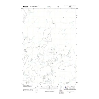
2011 Map of Black Hawk Mountain
USGS Topo · Published 2011About this map
Altemont Mine, Blue Ribbon Mine, and the American Eagle Mine underscore the deep-seated mineral legacy of Idaho County in the early 21st century. This high-country landscape is defined by its complex drainage systems, where Red Horse Creek and Wigwam Creek flow through narrow valleys toward the Red River at the southern edge. The terrain is marked by prominent elevations including Black Hawk Mountain and Simmons Ridge, with the latter overlooking the upper reaches of Spur Creek and Simmons Creek. Local Forest Service routes like FS RD 9821 and FS RD 423 provide the primary access to these remote mining sites and drainage basins. Farther south, the Hercules Mine and Pasadena Mine sit near the confluence of Ditch Creek and the Red River, illustrating the continued geographical importance of these historic gold and silver prospecting areas.
Find a feature on this map
31 named features on this map. Tap any name to fly to it.
Don’t see what you’re looking for? This feature index may not catch every label — zoom into the map to look around manually.
Map Details
Editions of this 2011 Black Hawk Mountain Map
This is the sole edition of this map. No revisions or reprints were ever made.
Other maps of this area

1956 · Elk City
USGS Topo · 1:250,000

1960 · Elk City
USGS Topo · 1:250,000

1966 · Elk City
USGS Topo · 1:24,000

1966 · Black Hawk Mtn
USGS Topo · 1:24,000

1966 · Lick Point
USGS Topo · 1:24,000

1966 · Sable Hill
USGS Topo · 1:24,000

1966 · Anderson Butte
USGS Topo · 1:24,000
1966 · Vermilion Peak
USGS Topo · 1:24,000

1977 · Boston Mtn
USGS Topo · 1:24,000

1978 · Moose Butte
USGS Topo · 1:24,000