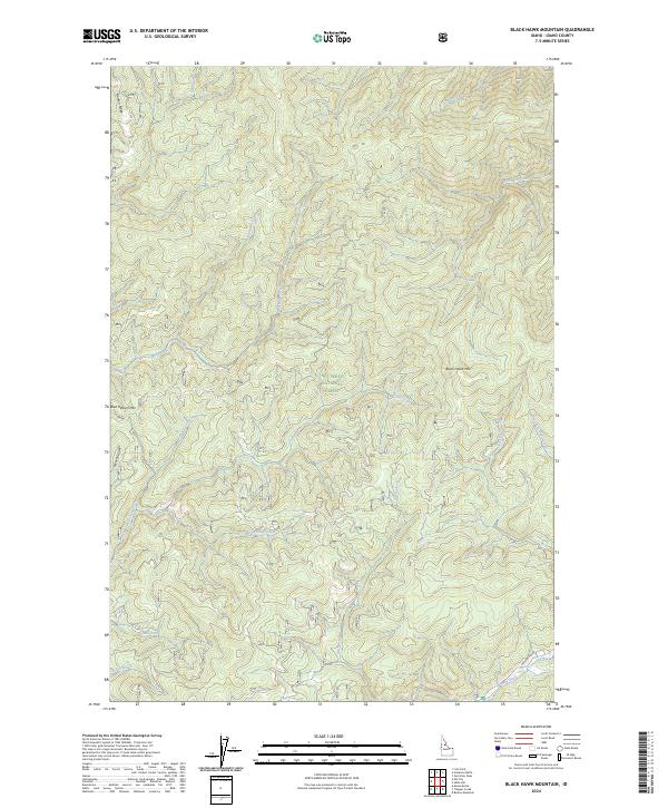
2024 Map of Black Hawk Mountain
USGS Topo · Published 2024About this map
Nez Perce National Forest dominates this mountain landscape, defined by high ridges and a dense network of drainages. The topography is anchored by prominent summits including Black Hawk Mtn and Blue Ribbon Mtn, with Flatiron Ridge rising in the northwest. Water courses carve through the terrain in every direction, from the larger Red River in the south to smaller tributaries such as Siegel Creek, Ditch Creek, and Simmons Creek.
Find a feature on this map
33 named features on this map. Tap any name to fly to it.
Don’t see what you’re looking for? This feature index may not catch every label — zoom into the map to look around manually.
Map Details
Editions of this 2024 Black Hawk Mountain Map
This is the sole edition of this map. No revisions or reprints were ever made.
Other maps of this area

1956 · Elk City
USGS Topo · 1:250,000

1960 · Elk City
USGS Topo · 1:250,000

1966 · Elk City
USGS Topo · 1:24,000

1966 · Black Hawk Mtn
USGS Topo · 1:24,000

1966 · Lick Point
USGS Topo · 1:24,000

1966 · Sable Hill
USGS Topo · 1:24,000

1966 · Anderson Butte
USGS Topo · 1:24,000
1966 · Vermilion Peak
USGS Topo · 1:24,000

1977 · Boston Mtn
USGS Topo · 1:24,000

1978 · Moose Butte
USGS Topo · 1:24,000