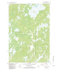
1983 Map of Black Lake
USGS Topo · Published 1983About this map
The Minnesota-Wisconsin border bisects this 1983 survey, where the heavy woods of the Nemadji State Forest meet the wetlands surrounding Black Lake. The terrain is defined by a complex network of waterways, including the West Branch and East Branch of the Moose River, as well as McDermott Creek in the southwest. Settlement is sparse, focused around small junctions and named roads that suggest the region's logging and agricultural history, such as the Swedish Highway and Moose Junction Road.
Find a feature on this map
19 named features on this map. Tap any name to fly to it.
Don’t see what you’re looking for? This feature index may not catch every label — zoom into the map to look around manually.
Map Details
Editions of this 1983 Black Lake Map
This is the sole edition of this map. No revisions or reprints were ever made.
Other maps of this area

1949 · Danbury
USGS Topo · 1:48,000

1949 · Holyoke
USGS Topo · 1:48,000

1949 · Webb Lake
USGS Topo · 1:48,000

1949 · Patzau
USGS Topo · 1:48,000

1953 · Duluth
USGS Topo · 1:250,000

1954 · Foxboro
USGS Topo · 1:24,000
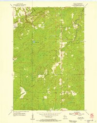
1954 · Patzau
USGS Topo · 1:24,000

1955 · Webb Lake
USGS Topo · 1:62,500

1955 · Patzau
USGS Topo · 1:62,500

1958 · Duluth
USGS Topo · 1:250,000