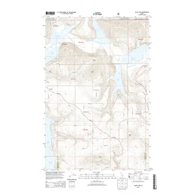
2014 Map of Black Lake
USGS Topo · Published 2014About this map
The Coeur d'Alene River winds through this northern Idaho landscape, feeding a string of lateral lakes that define the region's geography. This 2014 survey captures the distinct settlements of Springston and Lacon along the water's edge, while Harrison Flats occupies the higher ground to the south. The area is heavily influenced by the Coeur d'Alene National Forest, which covers much of the north and east, protecting terrain that rises toward Indian Mtn and Soloa Peak.
Find a feature on this map
66 named features on this map. Tap any name to fly to it.
Don’t see what you’re looking for? This feature index may not catch every label — zoom into the map to look around manually.
Map Details
Editions of this 2014 Black Lake Map
This is the sole edition of this map. No revisions or reprints were ever made.
Other maps of this area

1903 · Rathdrum
USGS Topo · 1:125,000

1955 · Spokane
USGS Topo · 1:250,000

1957 · St. Maries
USGS Topo · 1:62,500

1957 · Plummer
USGS Topo · 1:62,500

1957 · Coeur D'Alene
USGS Topo · 1:62,500

1957 · Lane
USGS Topo · 1:62,500

1958 · Spokane
USGS Topo · 1:250,000

1975 · Plummer SE
USGS Topo · 1:24,000

1975 · Coeur D'Alene SE
USGS Topo · 1:24,000

1975 · Plummer NE
USGS Topo · 1:24,000