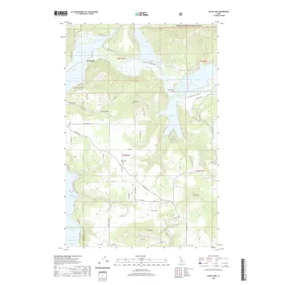
2020 Map of Black Lake
USGS Topo · Published 2020About this map
The Coeur D'Alene National Forest blankets the northern reaches of this Idaho landscape, where the Coeur d'Alene River feeds an intricate system of lateral lakes. The settlement of Springston sits along the northern banks, positioned near the Trail of the Coeur d' Alene's, which traces the historical rail corridor through the valley. This riverine network includes Thompson Lake, Blue Lake, and Anderson Lake, all linked by the shifting hydrology of the main channel.
Find a feature on this map
72 named features on this map. Tap any name to fly to it.
Don’t see what you’re looking for? This feature index may not catch every label — zoom into the map to look around manually.
Map Details
Editions of this 2020 Black Lake Map
This is the sole edition of this map. No revisions or reprints were ever made.
Other maps of this area

1903 · Rathdrum
USGS Topo · 1:125,000

1955 · Spokane
USGS Topo · 1:250,000

1957 · St. Maries
USGS Topo · 1:62,500

1957 · Plummer
USGS Topo · 1:62,500

1957 · Coeur D'Alene
USGS Topo · 1:62,500

1957 · Lane
USGS Topo · 1:62,500

1958 · Spokane
USGS Topo · 1:250,000

1975 · Plummer SE
USGS Topo · 1:24,000

1975 · Coeur D'Alene SE
USGS Topo · 1:24,000

1975 · Plummer NE
USGS Topo · 1:24,000