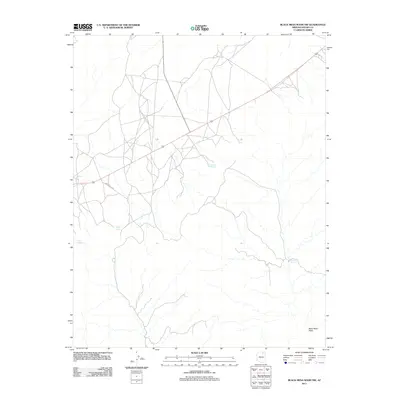
2011 Map of Black Mesa Wash NW
USGS Topo · Published 2011About this map
Pat Williams Spring and Frank Isaac Spring are prominent water sources on this high plateau landscape, illustrating the critical role of reliable springs in the arid environment of Navajo County. The 2011 survey reveals a territory defined by deep drainage systems like Shonto Wash and Black Mesa Wash, which carve through the terrain and influence the layout of local travel routes. Cultural features are sparse, with the presence of Indian Rte 6620 and other designated roads providing the primary framework for movement across this portion of the Navajo Nation. For researchers, these named landmarks—including Willow Spring and Sheepskin Spring—serve as essential reference points for understanding historical land use and seasonal migration patterns within the region.
Find a feature on this map
7 named features on this map. Tap any name to fly to it.
Don’t see what you’re looking for? This feature index may not catch every label — zoom into the map to look around manually.
Map Details
Editions of this 2011 Black Mesa Wash NW Map
This is the sole edition of this map. No revisions or reprints were ever made.
Other maps of this area

1883 · Marsh Pass
USGS Topo · 1:250,000

1892 · Marsh Pass
USGS Topo · 1:250,000

1956 · Marble Canyon
USGS Topo · 1:250,000

1959 · Marble Canyon
USGS Topo · 1:250,000

1961 · Marble Canyon
USGS Topo · 1:250,000

1970 · Cow Springs
USGS Topo · 1:24,000
1970 · Kydestea Spring
USGS Topo · 1:24,000

1970 · Black Mesa Wash NW
USGS Topo · 1:24,000

1970 · Whirlwind Rock
USGS Topo · 1:24,000

1970 · Shonto SE
USGS Topo · 1:24,000